When things are organized in conventional spherical space, their location is expressed in something like latitude and longitude, or right ascension and declination, or azimuth and elevation. Since these are all pretty much equivalent in expressing position, we can limit our discussion to the familiar lat/lon pair. The arguments presented here are equally valid in either frame of reference.
For this primer, let us use a sample database of places in the US. We build a tables from the supplied tab separated text file. The table of Places contains names and locations of cities as well as other census information. After ingesting the data into the tabes, we build a table called 'SpatialIndex' that will be essential for performing the searches that are based on spatial criteria.
Let's create the tables:
create table Place(
      HtmID       bigint       not null primary key, -- spatial index key
      PlaceName   varchar(100) not null, -- City name
      State       char(2)      not null, -- 2 char state code
      Population  int          not null, -- Number of residents (1993?)
      Households  int          not null, -- Number of homes (1993?)
      LandAreaKm  int          not null, -- Area in sqare KM
      WaterAreaKm int          not null, -- water area within land area
      Lat         float        not null, -- latitude in decimal degrees
      Lon         float        not null  -- longitude decimal degrees
);
You may need to modify the "bulk insert" command
in a way that makes sense at your installation. Here, we assume
that the file is in "C:\geodata\PlaceC.dat".
After populating the table, we direct SQLServer to create
an index.
EXEC('bulk insert Place from C:\geodata\PlaceC.dat;');
create index Place_Name     on Place(PlaceName);
go
Now, build the SpatialIndex
create table SpatialIndex (
  HtmID   bigint   not null , -- HTM spatial key (based on lat/lon)
  Lat     float    not null , -- Latitude in Decimal
  Lon     float    not null , -- Longitude in Decimal
  x       float    not null , -- Cartesian coordinates,
  y       float    not null , -- derived from lat-lon
  z       float    not null , --,
  Type    char(1)  not null , -- place (P) or gauge (G)
  ObjID   bigint   not null , -- object ID in table
  primary key (HtmID, ObjID) );
go
insert SpatialIndex
    select P.HtmID, Lat, Lon, XYZ.x, XYZ.y, XYZ.z,
        'P' as [Type], P. HtmID as ObjID
    from
        dbo.Place P cross apply Spatial.dbo.fHtmLatLonToXyz(P.Lat, P.Lon)XYZ;
DBCC INDEXDEFRAG    ( Spatial  , Place,   1);
DBCC INDEXDEFRAG    ( Spatial  , Place,   Place_Name);
DBCC INDEXDEFRAG    ( Spatial  , SpatialIndex, 1);
DBCC SHRINKDATABASE ( Spatial  , 1  ); -- 1% spare space
That's the setup. The function fHtmLatLonToXyz is an example of a table valued function that returns a table with a single row of x, y, values. It computes the values to be insert into SpatialIndex that are not available in Place.
Let's start with a query. Find all places that are within 5.5 miles from Baltimore. First, you need to know where Baltimore is and your first query will save the coordinates in variables that are used in the second query, all within the same transaction. For kicks and giggles, let's sort the result by distance in ascending order.
declare @BmID bigint
declare @Lat float, @Lon float
select  @Lat = Lat, @Lon = Lon ,  @BmID = HtmID
from Place
where Place.PlaceName = 'Baltimore'
  and State = 'MD'
select ObjID, dbo.fDistanceLatLon(@Lat,@Lon, Lat, Lon) as distance
from SpatialIndex
   where Type = 'P'
   and ObjID != @BmID
   and dbo.fDistanceLatLon(@Lat,@Lon, Lat, Lon) < 5.5 -- fine test
	order by distance asc
go
The result is a table of nine entries
ObjID                distance
-------------------- ----------------------
14027134015006       4.36933806169942
14027147088778       5.00921492020043
14027134438340       5.02800293806116
14027141421282       5.15631204057331
14027134374429       5.18978361111267
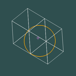
The function fDistanceLatLon computes distance between two locations specified by lat/lon pairs. This is an expensive computation, it would be nice to get the same result but without performing this computation on every place in the database. That's where the coarse filtering of covermaps come to the rescue. We use the covermap to filter out those objects, whose ObjID is not in any of the intervals returned by covermap. If Lat = 39.3008 and Lon = -76.610616 (as defined from the preceding SQL code), then the covermap is:
select * from dbo.fHtmCoverCircleLatLon(39.3008, -76.610616, 5.5)
HtmIDStart           HtmIDEnd
-------------------- --------------------
14027133550592       14027134599167
14027137744896       14027142987775
14027144036352       14027145084927
14027146133504       14027147182079
14027151376384       14027152424959
14027159764992       14027160813567
There is a bit of an overshoot, causing some false positives to be included in the covermap, but it is still a small number of objects against which to test for distance, when compared with all the objects in the database. The query that uses the covermap, with the top identical bit of the query deliberately omitted is as follows
...
select ObjID, dbo.fDistanceLatLon(@Lat,@Lon, Lat, Lon) as distance
from SpatialIndex
	join fHtmCoverCircleLatLon(@Lat, @Lon, 5.5)
	On HtmID between HtmIDStart and HtmIDEnd           -- coarse test
  where Type = 'P'
	and @BmID != HtmID -- rule out baltimore
   and dbo.fDistanceLatLon(@Lat,@Lon, Lat, Lon) < 5.5 -- fine test
	order by distance asc